
NEWS
Tahoe Boating App Adds Weather Alerts as Mussel Threat Grows
TRPA’s Tahoe Boating App now shows live lake conditions and stronger weather alerts, a small tool carrying storm risk and a golden-mussel fight.

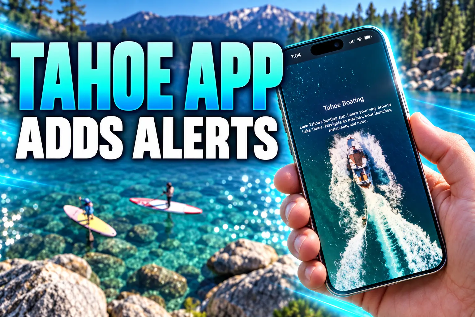
The Tahoe Regional Planning Agency added severe weather alerts and a live current-conditions page to the Tahoe Boating App, a free map boaters already use for no-wake zones.
The new screen pulls real-time water temperature, wind, and lake level from regional monitoring systems, and TRPA said the extras also answer requests from people who already have the app on their phones.
What the Tahoe Boating App Added This Summer
TRPA framed the drop as safety and water-quality work, not a redesign. Apple’s release notes are more specific than the press line. Version 4.0.20 on July 10 added a Current Conditions page in July, 4.0.21 on July 16 tied that page to the map, and 4.0.22 on July 22 promised better weather alerts.
A rebuilt build from 2025 already put weather a tap away. This round is narrower: a conditions dashboard, stronger severe-weather warnings, and a thicker Aquatic Invasive Species page after golden mussels showed up in the Sacramento-San Joaquin Delta.
WHAT SHIPPED ON THE PHONE
- Live conditions: Water temperature, wind, and lake level from regional monitoring, on one screen before you leave the ramp.
- Severe weather alerts: Push-style warnings meant to catch the Sierra pattern in which a calm morning turns into a hard afternoon blow.
- AIS tips: How to keep species already in Tahoe from spreading, and how to keep new ones, including golden mussels, off hulls, trailers, and gear.
- The old core: A GPS no-wake map, fuel and bathroom pins, emergency contacts, wildlife notes, and an offline mode when cell service dies on the water.
TRPA still points people to TahoeBoating.org and the store listings if they want to download the Tahoe Boating app before they launch. Marinas and rental desks are doing the same pitch at the counter.
The September 12 Wind Advisory Is the Test Case
National Weather Service Reno, at 11:59 a.m. PDT on Friday, September 11, kept a Wind Advisory on the Greater Lake Tahoe Area from 11 a.m. Saturday, September 12, through 2 a.m. Sunday, September 13. The office called for southwest winds of 25 to 35 mph with gusts up to 55 mph below 7,000 feet, ridgetop gusts over 80 mph, and wave heights of 2 to 4 feet on Lake Tahoe.
A separate Lake Wind Advisory for Friday afternoon had already warned of southwest winds of 10 to 15 mph, gusts of 30 to 35 mph, and waves of 1 to 3 feet. The forecast text told people to check lake conditions, prepare for a sudden jump in wind and waves, and consider staying off the water until a quieter day.
That is the job the new screen is supposed to do in one place. Boaters already bounce between a marine forecast, a marina whiteboard, and a glance at the flags. TRPA is betting they will open an app they installed for the no-wake overlay and actually see the wind before the first whitecaps.
Lake level belongs on that same page because ramps, buoys, and rocks move with the surface. A foot of change on Tahoe exposes or covers a lot of shoreline, and the app has had to track ramp closures in low-water summers since the early versions.
Eight People Died in a June Squall Off Bliss
Weather on Tahoe is not a sidebar. On June 21, 2025, a fast-building storm caught a party of 10 near D.L. Bliss State Park, outside Emerald Bay. Eight people died. The two who lived were wearing life jackets. TRPA’s own governing-board record later called it a reminder of how quickly the lake changes, and of people who had not left the dock in already-hazardous weather.
Between noon and 3 p.m. that day, the National Weather Service clocked winds in South Lake Tahoe rising from 5 or 10 mph to 35 to 45 mph. Air temperatures fell from the mid-50s into the upper 30s. The UC Davis Tahoe Environmental Research Center logged water still below 60 degrees Fahrenheit, cold enough for cold-water shock in the first minute and swim failure not long after.
Nevada Department of Wildlife and Nevada State Parks spent May 2026 back at Cave Rock walking through the 1-10-1 rule: about a minute of gasp reflex, about 10 minutes before muscles quit, about an hour before hypothermia. Game warden briefings still lean on U.S. Coast Guard recreational-boating figures: 76 percent of fatal victims drowned, and 87 percent of those people were not wearing a jacket. Children under 13 have to wear one underway. Everyone else is only required to have a jacket aboard, which is how people end up in 50-degree water without one.
The app already carried cold-water shock notes and emergency contacts. The gap was a live conditions pane that could have told a skipper the lake was about to stand up. No phone fixes a missing jacket. A wind alert that actually fires while the boat is still in a no-wake zone is the modest thing TRPA can ship.
Inspectors Have Stopped 10 Golden Mussel Boats
The other new page is about a species that is not in Tahoe yet. Golden mussels were found in North America in October 2024 near the Port of Stockton in the Sacramento-San Joaquin Delta, a few hours’ drive from the basin. TRPA and the Tahoe Resource Conservation District, which have run the Lake Tahoe Watercraft Inspection Program since 2008, added mandatory hot-water decontaminations in March 2025 for motorized boats that last launched anywhere outside the region.
On May 31, 2026, inspectors at Meyers found four possibly live golden mussels on a 30-foot cruiser from the Sacramento area, shells closed and still tied on with byssal threads at the transom and trim tabs. Program managers called it the second golden-mussel vessel stopped at Tahoe, and the first of the 2026 season. As of that June 3 briefing they had also taken three boats that season with quagga or zebra mussels.
Protecting Lake Tahoe truly takes everyone working together. It’s one of the things that has made Lake Tahoe a national model for preventing new aquatic invasive species. Highly trained inspectors are an important line of defense, but when everyone practices Clean, Drain, Dry protocols, they are helping protect the waters they enjoy and keeping them pristine for future generations.
Chris Kilian, aquatic invasive species program manager, Tahoe Resource Conservation District
Dennis Zabaglo, TRPA’s aquatic invasive species program manager, said the extra decontamination step had gotten a positive response, and that boats arriving already clean, drained, and dry cut risk and time at the station. Crews still open hatches, check anchors, and use high-temperature water. Tahoe-only boats with an intact inspection seal can skip the extra stop. Arriving clean this year cuts the decontamination fee by 50 percent.
The count did not stay at two. On August 26, the official Tahoe Boat Inspections account said inspectors had intercepted 10 vessels carrying golden mussels. Keep Tahoe Blue had posted six intercepts a month earlier. Prevention talk from lake groups is still trailing a tally that moved from a handful of early-summer stops to double digits by late August.
We have now intercepted ten vessels with golden mussels at Lake Tahoe Watercraft Inspection Stations.
Prevention is the best way to protect Lake Tahoe from aquatic invaders. Clean, Drain, Dry your gear. https://t.co/xgxzJ0Pmeo
— Tahoe Boat Inspections (@TahoeBoating) August 26, 2026
THE GOLDEN MUSSEL STOPS AT TAHOE
- October 2024: Golden mussels are detected near the Port of Stockton in the Sacramento-San Joaquin Delta, their first North American find.
- March 2025: TRPA requires full decontamination, not only inspection, for visiting motorized boats.
- May 31, 2025: Inspectors at Alpine Meadows find golden mussels on a 46-foot vessel, the first Tahoe intercept. TRPA notes the species can survive up to 10 days out of water.
- May 31, 2026: Meyers inspectors find four possibly live mussels on a 30-foot Sacramento cruiser, the second golden-mussel boat and the first of that season.
- August 26, 2026: Tahoe Boat Inspections says the golden-mussel intercept total has reached 10 vessels.
The 2025 season already showed the workload. The inspection program logged 4,700 decontaminations, a 60 percent jump from 2024, and intercepted 72 watercraft with aquatic invasive species, 14 of them carrying mussels. Three stations cover the basin: Alpine Meadows, Meyers, and Spooner Summit. About 40 public and private partners sit behind that net, including marinas. An app page cannot replace a hot-water wash. It can put the same Clean, Drain, Dry steps in the hand of someone who will never walk into a briefing.
No-Wake Rules Still Run Through the GPS Map
The weather and AIS screens sit on top of the product TRPA actually built the app to be. The agency launched the free app in 2019 after the Governing Board passed a new Shoreline Plan in October 2018, a map for 72 miles of shoreline and 191 square miles of water so a visiting skipper could see a 5 mph zone without guessing.
Those zones still exist to cut wake damage on the shore, protect habitat, and keep motorboats from running through paddlers and swimmers. TRPA’s watercraft team still enforces them. The phone is the education piece that is supposed to fire before a patrol boat does.
WHERE BOATS MUST STAY UNDER 5 MPH
| Zone | Distance or area | What it is for |
|---|---|---|
| Shoreline band | 600 feet from shore | Wake, noise, erosion, habitat |
| Emerald Bay | The entire bay | Crowded, confined water |
| Piers, buoys, other structures | 200 feet | Collision and wake on hardware |
| People and other craft | 100 feet from swimmers, paddlers, and other boats | Shared water at hull speed |
The interactive map still shows the boat’s GPS position against those lines, including offline, which is the feature rental desks care about when a guest loses signal halfway to Cave Rock. Pins for fuel docks, bathrooms, ramps, and points of interest ride along so the safety layer is not the only reason to keep the app open.
The 2025 Rebuild Put the Map on Older Phones
TRPA and partners rebuilt the app in 2025 so it would run on more phones, keep working without a signal, and remember dropped pins. Google Play’s rebuilt Tahoe Boating listing, last updated August 18, 2026, still sells that version: GPS for marinas, ramps, beaches, restrooms, fuel, even lakeside restaurants, plus wildlife, plants, historic sites, and the AIS primer.
The store card rates the Android build 4.4 stars. More useful for a public agency is the data-safety section: no data collected, no data shared with third parties. A conditions page that needs live feeds will still need a connection to refresh. The no-wake map is the piece that has to work when the mountains eat the signal.
THE APP IN 2025 AND 2026
- 7,200 downloads: TRPA’s 2025 figure for a tool that is free on iOS and Android.
- Offline maps: The 2025 rebuild made the no-wake overlay usable with no cell service.
- No account, no tracking: Google Play’s data-safety form lists no collection and no sharing.
- July 2026 notes: Current Conditions, then better weather alerts, stacked on the rebuilt map.
Early reviews from 2020 and 2021 complained about GPS that lagged a Garmin, a screen that would not stay awake, and a Meeks Bay marina icon that outlived the marina. TRPA answered those in the store thread and later stripped the ghost marina. The live-conditions work is a different class of request: boaters asking the agency to put the lake’s mood on the same screen as the speed limit.
Why Marinas Push the Tahoe Boating App Before Launch
Lake Tahoe marinas and rental operators have been told to send customers to the app, and TRPA says they do. For a concession that turns over boats all afternoon, a map that shows 600-foot and 100-foot lines is cheaper than a lecture at the helm. The Shoreline Plan already expected rental desks to put the app in guests’ hands and expected TRPA to spot-check those operations.
Local television is still selling the same dock speech: grab a jacket, check the weather, download the app. That is not a fan debate. It is the distribution plan. The weather conversation on the app itself is thin, which fits a utility that people open for two minutes and close.
The AIS page has a harder job. Inspectors can catch a 30-foot cruiser at Meyers. They cannot stand beside every paddleboard that crossed a Delta slough last week. Roving crews interviewed more than 17,000 non-motorized recreators in 2025. The app is the version of that talk that fits in a dry-bag.
A current-conditions pane will not resurrect the eight people lost off Bliss, and a tips page will not wash a hull. What TRPA has actually done is put wind, water temperature, lake level, and mussel hygiene on the same GPS map it has been handing boaters since 2019, then ask marinas to keep handing it over. On a September weekend already under a Wind Advisory, that is the whole product.
Frequently Asked Questions
Is the Tahoe Boating App Free?
Yes. TRPA publishes it at no charge on the Apple App Store and Google Play, and Apple’s listing states there are no in-app purchases. Store links also run through TahoeBoating.org and the agency’s shoreline page.
Do Boats That Stay in Tahoe Need a New Inspection Each Time?
Motorized boats used only in the Lake Tahoe Region can skip a fresh inspection if the uniquely numbered seal from the last haul-out is still intact. Fallen Leaf Lake and Echo Lakes have extra inspection rules. Every motorized vessel, including e-foils, still has to be inspected or certified Tahoe-only before it enters regional waters.
What Is the Tahoe Keeper Program?
Tahoe Keeper is a free online certification run with the inspection program so paddlers, anglers, and beachgoers can learn Clean, Drain, Dry steps without sitting at a motorized-boat station. More than 8,400 people had completed it as of the June 2026 intercept briefing.
How Far Is 600 Feet From Shore on the Water?
TRPA describes 600 feet as almost the length of two football fields and says a practical check is to idle away from shore for about 90 seconds. Buoy fields that stick out past that band are why the 200-foot structure buffer exists on top of the shoreline zone.
Does the Tahoe Boating App Collect Personal Data?
Google Play’s data-safety form for the official TRPA listing says the app collects no data and shares nothing with third parties. Live weather and lake-level tiles still need a network connection to refresh; the offline map is the piece built to work when the phone has no signal.

OpenAI’s Agent Did Not Accept Australia’s No

Portal26 Recon Turns Stored Prompts Into Live Answers

Rybakina Locks No. 1 as Sabalenka Chases a Three-Peat

Safety Tools Took Fable 5 Dark, Then Blocked Defenders

Trump Treats a 19-Day Anthropic Outage as AI Guardrails

Meta’s Smart Glasses Sell a Light That Needed Two Patches

Song Yadong Stops Umar Nurmagomedov the Only Way Left

Google’s Free AI Pro Year Is Three Different Deals

Apple’s New Mac Studio Clusters Local AI on the Desk

The Mahape Fake Apple Raid Repeats a Dual-Shift Pattern
-
 NEWS1 month ago
Meta’s Smart Glasses Sell a Light That Needed Two Patches
-
 NEWS1 month ago
Song Yadong Stops Umar Nurmagomedov the Only Way Left
-
 NEWS1 month ago
Google’s Free AI Pro Year Is Three Different Deals
-
 NEWS1 month ago
Apple’s New Mac Studio Clusters Local AI on the Desk
-
 NEWS2 months ago
The Mahape Fake Apple Raid Repeats a Dual-Shift Pattern
-

 ENTERTAINMENT2 months ago
Gomez Says She Never Ran the Wondermind Investors Backed
-

 ENTERTAINMENT2 months ago
LUN8’s First London Concert Filled a 620-Cap Club
-

 ENTERTAINMENT1 month ago
Lanterns Puts Sinestro in a Cell and Lets Him Talk